
El Castillón
On a crag in the Dehesa de Tardajos, beside the Esla, this site holds the longest historical sequence in the municipality: from rock painting to a fortified centre of late antiquity.
A waymarked path of 1.5 km from Puente Quintos, on foot only · the archaeological areas are not open access
Why it matters
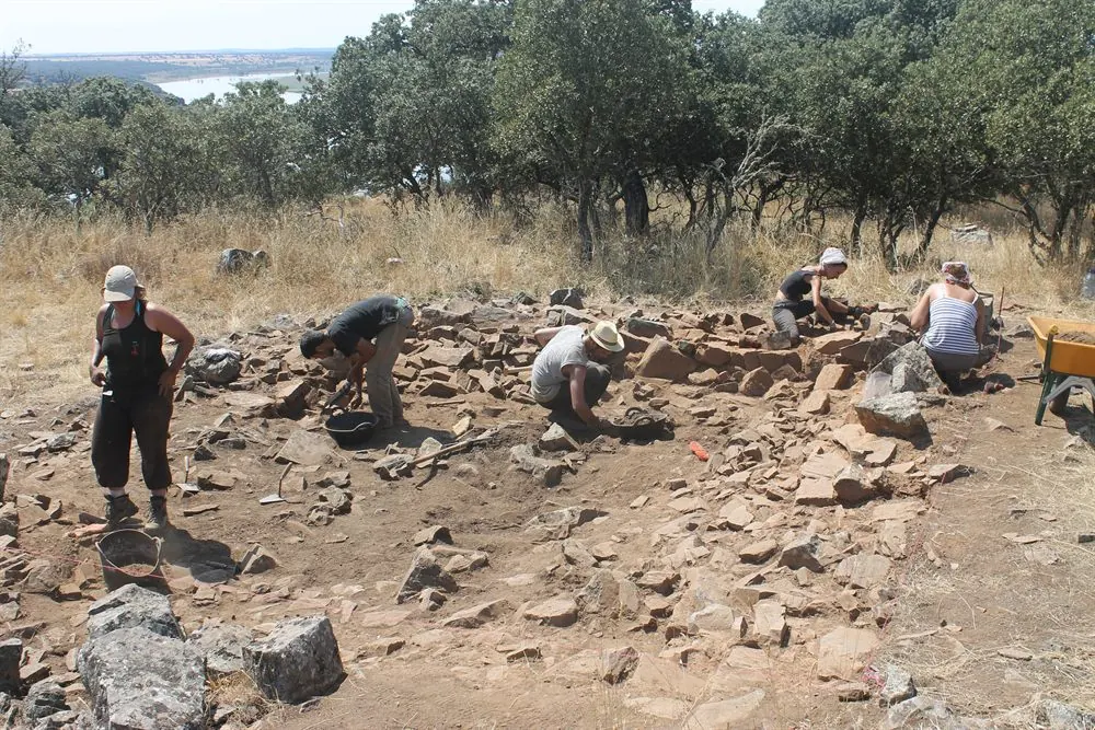
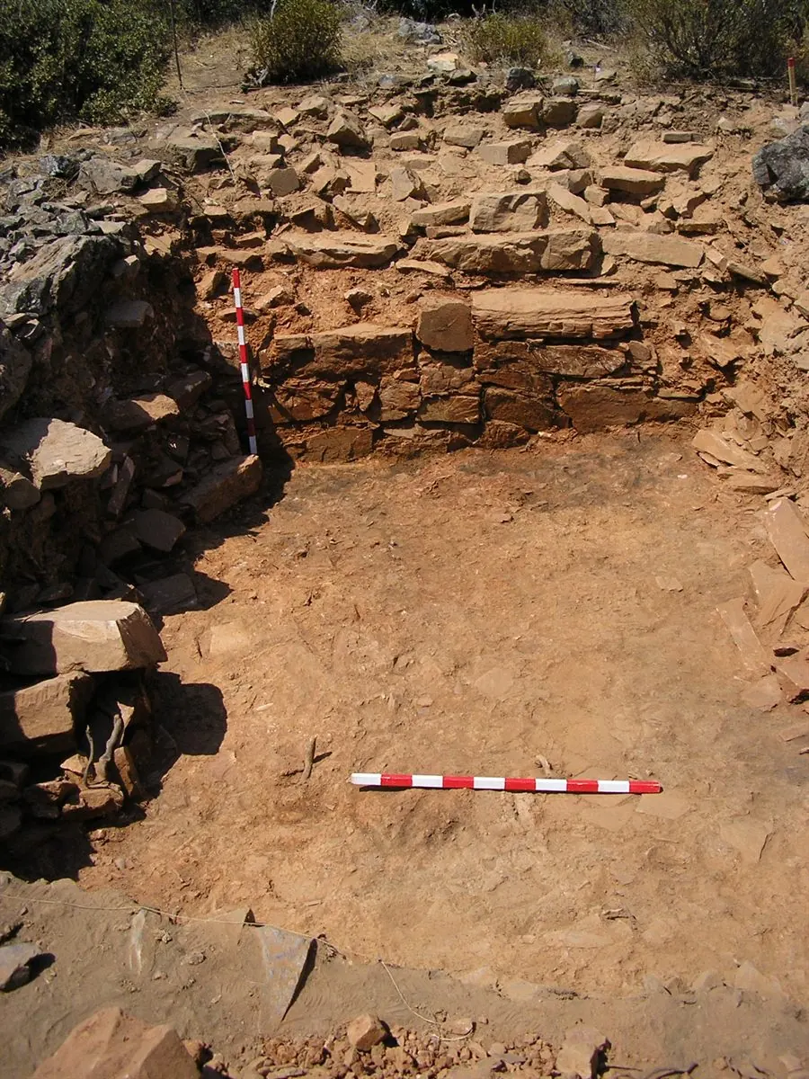
El Castillón is a site of scientific importance: a fortified settlement of the 5th-6th centuries, with walls, houses, storerooms and kilns, abandoned at the end of the 6th century and reoccupied in the 9th-10th centuries with a church and burials. The University of Salamanca presented its findings in 2026 in the exhibition «La Meseta del Duero después de Roma». Few rural visits let you look into that period, so rarely present in tourism.
Its position explains the territory: the ford across the Esla, the defensive position on the crag and the landscape now flooded by the Ricobayo reservoir.
Documented chronology
- Prehistory Schematic painting. A human figure drawn in very basic strokes, in a shelter among the rocks: the only schematic rock art recorded in the whole province of Zamora. It is a sensitive site: this website does not publish how to reach it, and visiting it requires technical authorisation.
- Iron Age Early occupation of the spot, documented by archaeological research.
- 5th-6th centuries Fortified centre. Walls, houses, storerooms and a metalworking area; abandoned at the end of the 6th century.
- 9th-10th centuries Early medieval reoccupation. A church and burials over the old settlement.
- 2026 Scientific outreach. The University of Salamanca presents the site in the exhibition «La Meseta del Duero después de Roma».
Getting there
The path from Puente Quintos · 1.5 km, about 30 minutes
This is the usual and easiest way in. Drive to Puente Quintos, on the ZA-123 road, and park on the track that leads to the Reserva Quintos: there is a small clearing on the right-hand side.
Where the path starts: at the end of the bridge on the Santa Eulalia de Tábara side, on the right, signposted with the Camino de Santiago Sanabrés marker. Coming from Santa Eulalia it is right there as you reach the bridge; coming from the other side, cross the bridge and take the path on the right.
The walk is 1.5 km and well waymarked, because it is part of the Camino Sanabrés. It runs almost all the way along the bank of the Esla and turns off at the end to reach the site. You return the same way, so there and back comes to about 3 km.
It is a narrow, winding path that at several points crosses the rocky outcrops of the Esla canyon cliffs. There is no technical difficulty, but wear closed shoes, take your time and keep an eye on children. The waymarking reserves it for walkers: a sign expressly rules out cyclists because of the state of the ground.
From the site there are fine views of the river Esla and of the Santa Eulalia dam.
By bicycle, on a different route
The riverside path takes no bicycles, but you can cycle in from Santa Eulalia de Tábara along the farm consolidation tracks: about 40 minutes. It is a separate route from the Puente Quintos one, across open country.
The route, step by step
The full route is published on Wikiloc: Yacimiento arqueológico El Castillón · Puente Quintos. It was shared by a user of the platform and is not official town council waymarking: use it as a guide and, if you are coming out of season or after rain, ask about the state of the path on the information line, +34 686 70 21 03.
Before you set off
- Getting there does not entitle you to enter. The excavated areas and the shelter with rock art are protected: they are looked at from the outside, with nothing stepped on or touched.
- On foot only. The path is narrow and runs between rocks above the canyon: it is no place for a bicycle or a pushchair.
- There are no services at the site: no water, no guaranteed shade, no toilets. Bring water, especially in summer.
- Park where you should. In the clearing on the track to the Reserva Quintos; do not park on the bridge or on unmarked verges.
Before setting off for El Castillón, confirm the state of the track and the limits of the visit.
Plan your visit